LIFE & TIMES AT CONSOL
I've talked about historical stuff and nostalgic stuff at Brazos Buildings & Businesses, and at one time or another had planned a big feature for A&M Consolidated High School.
Instead, I mostly wanted to create a page that has some photos I took as a high schooler (indeed, the blog launched when I was still there) and some maps of how its changed over the years, with both the original early 1970s map and the map as it appeared in the late 1990s and early 2000s. While there were some minor renovations since, it's changing again with a big two-story addition near the cafeteria (presumably building a second floor over the cafeteria), and even at the time I went there it felt like a jumble of parts slammed together.
I don't have any wacky school stories to be shared here...I figured that most of those are best to be shared anonymously, which I've done on Internet forums or in person.
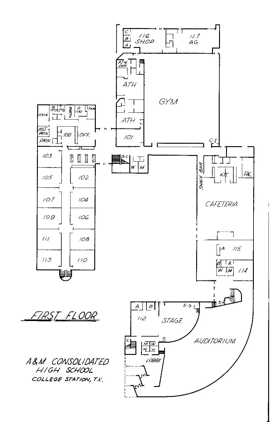
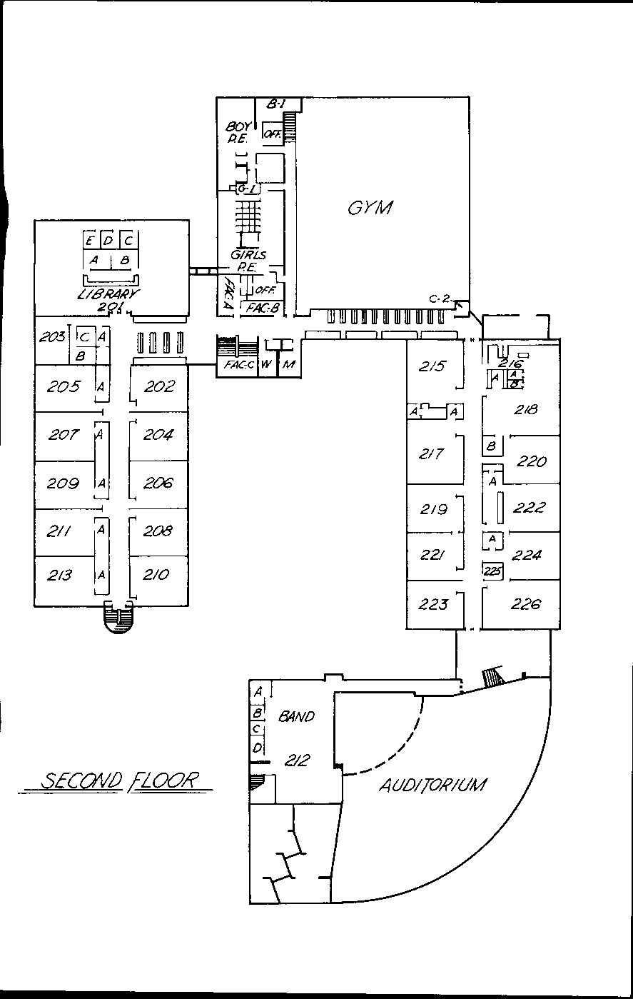
While I didn't find this until after I graduated, this is the plan of the high school in the early 1970s. The current site of the offices (at least of the late 2000s) is where the gym is in this plan.
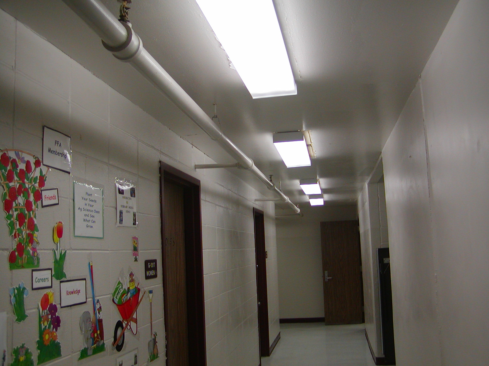
I took a few photos and videos in 2009 but the only one of interest is a corridor in the Ag Science, a spooky wing that was the last to be added in the days before the late 1990s renovation but first to be done in 2010s renovations.
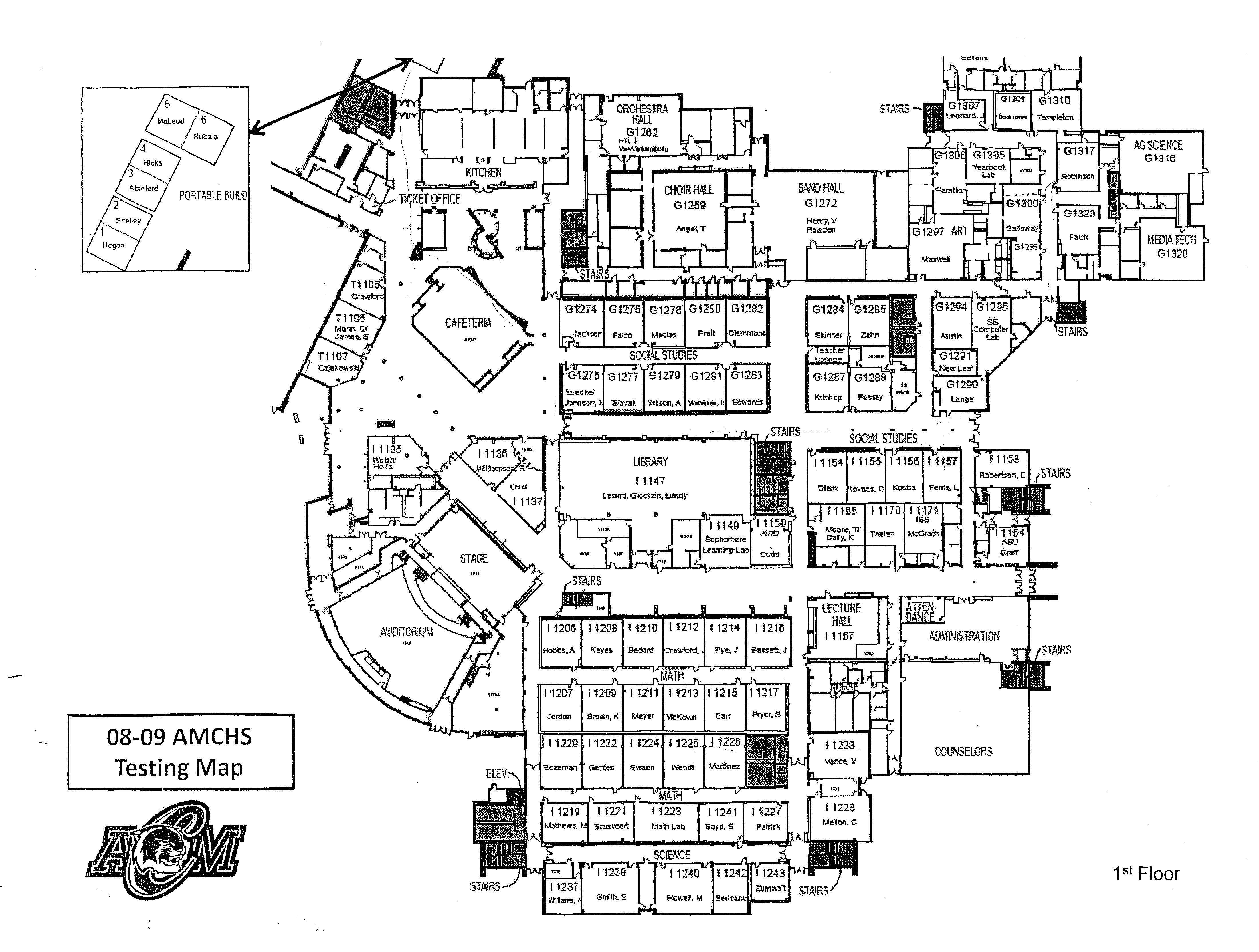
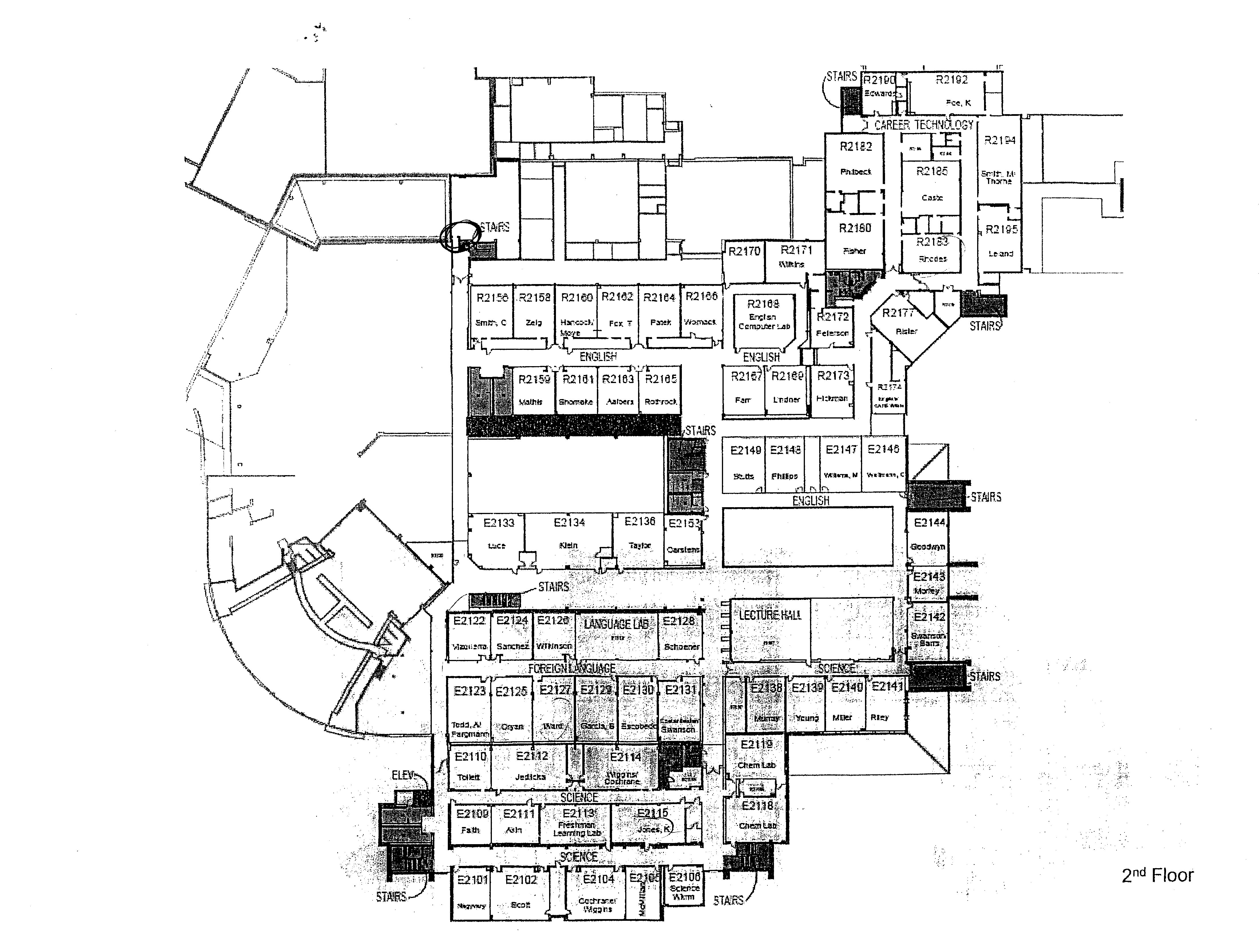
So, on with the maps (and single photo). They're from a slightly different perspective, the 1970s one faces Welsh, the 2000s one faces Harvey Mitchell Parkway. Right click for larger size...
Return to Main Page | Contact Me
Copyright 2026 Carbon-izer.com